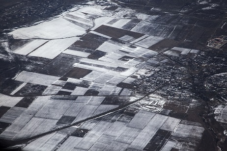
Aerial photograph shows Georgia from new angle
 Tweet
Tweet  Share
Share
Georgia has announced an international tender for a project worth almost 4 million GEL to take an aerial photograph of the country.
Any foreign or local company is invited to take part in the tender and submit appropriate documentation before the end of April deadline.
The tender has been announced as part of the Maps for Sustainable Land Management – Georgian Orthophoto project by Georgian National Public Registry and Norwegian Mapping Authority Statens Kartverk.
Under the terms, the winning company must shoot a full aerial photograph of Georgia. After the shooting is finished, the company will process the data and create an orthophotograph.
An orthophotograph is an image that transforms a vertical aerial photograph into the equivalent of a traditional map while still retaining the advantages of a photograph, such as actual cultural and land features and the natural environment rather than representing those features using symbols and lines.
This will be the first time a project of this scale, which foresees taking a unified aerial photo of the whole country, will be implemented in Georgia.
The Maps for Sustainable Land Management – Georgian Orthophoto project is expected to cost about €1.7 million (3.9 million GEL) and is being financially supported by the Norwegian government.
Officials hoped the project would be completed in 2017.
Meanwhile aerial photographs of specific areas of the country were taken on three earlier occasions following the request of the Georgian Government; in 2000, 2005 and 2010. However due to the absence of a relevant action plan, the shootings were carried out spontaneously, with significant technical mistakes.
The Georgian Public Registry noted the new project would significantly improve property rights, land planning and land management. In addition, the complete photograph would help for better understanding of geographic data and better response to natural disasters.