Aerial photos of Vere River basin will assist Tbilisi flood recovery
 Tweet
Tweet  Share
Share
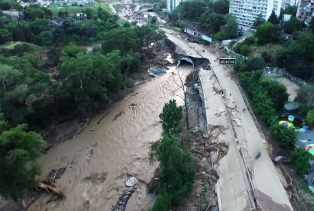
A department within Georgia's Ministry of Justice is utilising a small plane to take aerial photographs of the Vere River basin to better analyse the scale of the damage caused in the June 13 flood.
The Georgian Public Registry will carry out the task and a total land area of 200km2 would be surveyed.
The agency noted the photos would significantly contribute to the overall understanding of the disaster, help the team better evaluate the damaged caused and implement an appropriate rehabilitation plan. The photos would also help the team with future natural disaster planning.
The agency said the "strategically important information" received from the aerial photos would be given to all Governmental agencies for further inspection.
"Our project, which foresees shooting a single aerial photograph of the whole country, began in January. We have started preparatory works but the disaster plotted new priorities for us and we decided to react instantly,” said head of Public Registry Papuna Ugrekhelidze.
"With financial support of the Norwegian government, an additional grant was provided and it was decided to shoot aerial photographs of the Vere River basin. The data received will really be information of state importance that will not only be useful for the public registry,” he said.
The aerial photo shoot will be conducted by Ukrainian company Aviation Accounting Centre along with Georgian Public Registry specialists.
Georgia has announced an international tender for a project worth almost 4 million GEL to take an aerial photograph of the country.
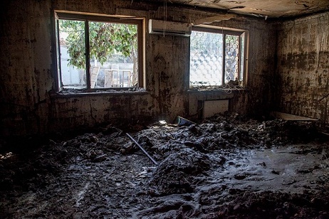
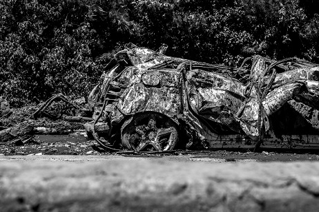
It's been one month since Georgia’s capital Tbilisi was hit by a deadly flash flood which turned out to be the city’s worst human and infrastructural disaster in years.

The people of Hungary are honouring the memory of the victims of the disastrous June 13 flood in Tbilisi, which caused the deaths 23 people.
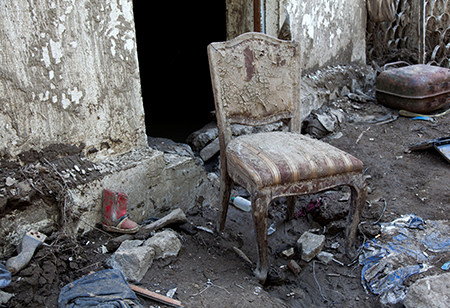
Exactly two months have passed since Georgia’s capital Tbilisi was hit by a deadly flash flood, which turned out to be the city’s worst human and infrastructural disaster in years.
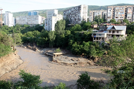
The series of orthophotographs capture the full extent of damage to infrastructure and the environment caused in the June 13 Tbilisi flood.
A body found in Tbilisi last month has been identified as one of the three missing victims of June 13 Tbilisi flash flood.
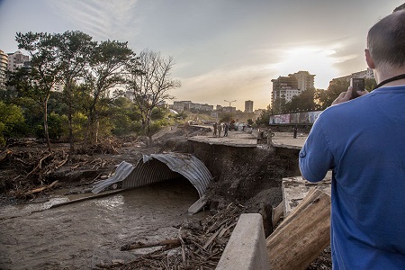
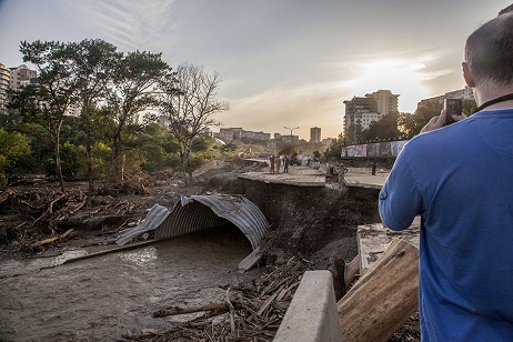
All of the roads that were extensively damaged in the deadly flood that hit Tbilisi on the night of June 13 have been fully restored and reopened.
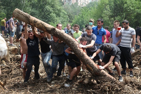
Exactly six months has passed since Georgia’s capital Tbilisi was hit by a deadly flash flood, which turned out to be the city’s worst human and infrastructural disaster in years.
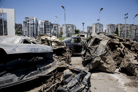
People whose cars were damaged or fully destroyed in the June 13 flood will be offered compensation, announced Tbilisi Mayor’s Office today.
Today marks exactly one year since Georgia’s capital Tbilisi was hit by a deadly flash flood, which turned out to be the city’s worst human and infrastructural disaster in years. Twenty-one people lost their lives in the flood on the evening of June 13, 2015. The bodies of two of these victims have still not been found.
What has been done to restore Tbilisi after June 13 flood?
In the past 12 months the Georgian Government, foreign governments, private companies and ordinary citizens have united to help Tbilisi rise up from disaster and return to its former glory.
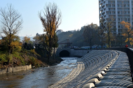
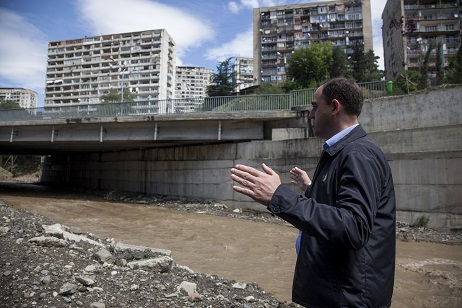
Stage one of reinforcing works along the edge of the Vere River have been completed - almost 18 months after the river burst its banks in the deadly flash flood on June 13 last year, leaving 21 people dead, two still missing and city infrastructure heavily damaged.