Explore Georgian cultural heritage in South Caucasus on digital map

A comprehensive digital map for Georgian historical architectural monuments outside the country’s present borders has been launched by the Culture Ministry today.
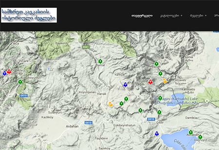
The interactive map – a project organised by the Aleksandre Javakhishvili Geographic Society and financed by the Shota Rustaveli National Science Foundaion – is based on Google Maps technology and includes 102 significant "fully documented” monuments throughout Turkey, Armenia and Azerbaijan.

A screenshot of the digital map from the project website.
The website for the project does not offer a fully-fledged English version of the interface, however individual pages for monuments do offer English translations of their descriptions next to information in Georgian.
The map features a panoramic display, photo gallery, architectural plans and description for each entry in the database including newly discovered monuments as well as a digital book featuring illustrations and information on the subject.
The information on the website is organised into multimedia catalogues, while the list of monuments can be sorted according to their type, location or historical period.
The map can be viewed at the following link: http://maps.nekeri.net
 Tweet
Tweet  Share
Share